I have spoken to several people, who seem genuinely confused by my statement that 3 Suburban Road is a wetlands. The developer doesn’t seem to understand either. It’s not their fault. Current maps of the area DO show a wetlands in the northwest corner of the property. It’s small and seems fairly irrelevant to the proposal at hand aside from the 100 foot buffer zone required by the Worcester Wetlands Ordinance. That barely affects most of the land and it’s hardly some great revelation. It’s not what I am talking about.
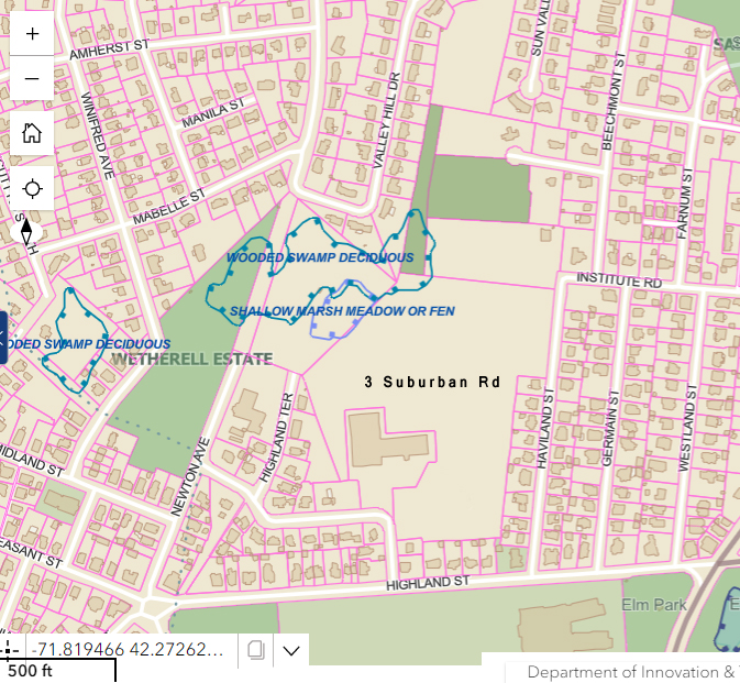
When I say 3 Suburban Road is functioning as a wetlands, I mean the whole property, or most of the property appears to be serving the role of a wetlands. Wetlands are more than just aesthetically nice; they protect groundwater, filter pollutants, and help prevent flooding. The larger the wetlands, the greater the impact they have. In this case, we are likely talking about 8 or 10 acres of wetlands, if not more. That’s a pretty significant water retaining and detaining facility, and it just happens to be surrounded by houses, infrastructure, and schools. If it were to be prevented from holding water, that water would inevitably move elsewhere, and the only place left or it to go would be a street or a building. That’s common sense.
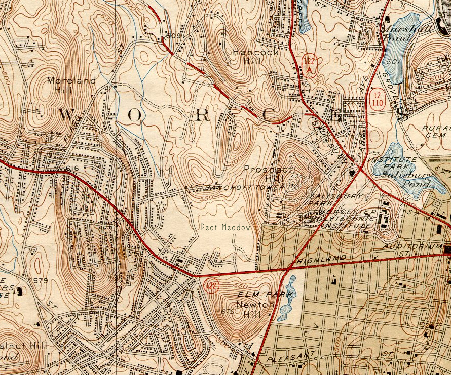
Okay but HOW do we know that whole area is a wetlands? It isn’t marked on these maps, so how can I be making such a crazy claim?
Well, yes, it isn’t on a map. If it was this whole argument would be a lot easier. It isn’t any kind of officially designated wetlands, nor is it recognized by the Department of Environmental Protection. You see, to be an official wetlands, it would need to show the presence of certain types of flora. Obviously we don’t have that. We would also need to show some streams feed the area. But we don’t have that either, because the inflow of water into the properry comes from unmapped underground springs. We can see the springs with our own eyes, but apparently the fact that they aren’t on a map means they aren’t real. You see the problem. Wetlands do, however, show a particular set of geologic markers, and that we DO have.
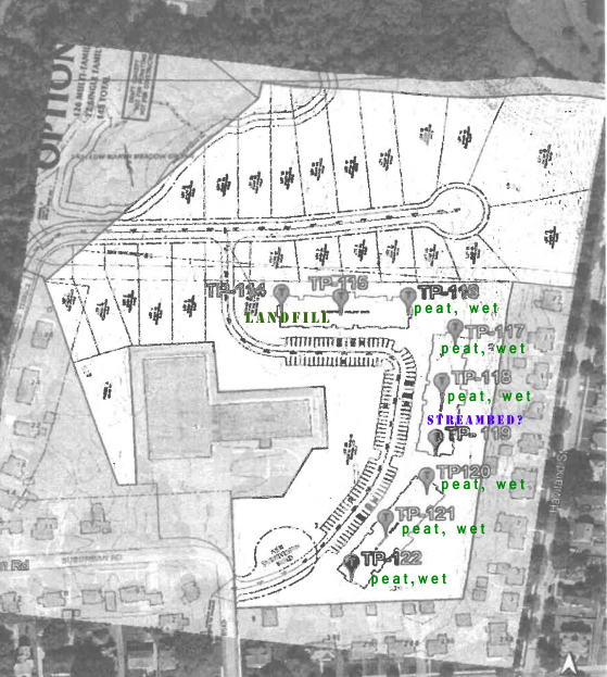
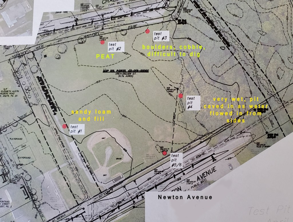
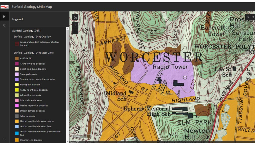
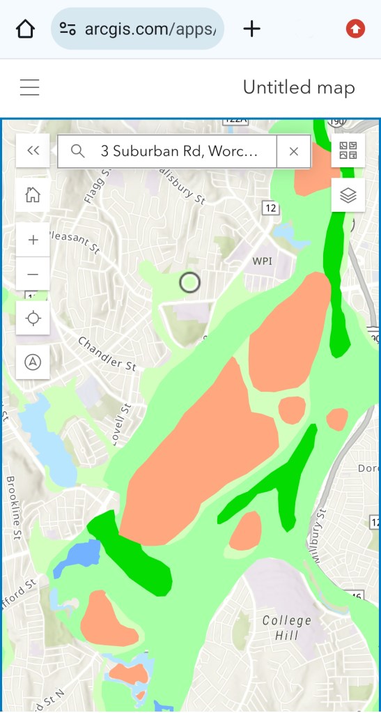
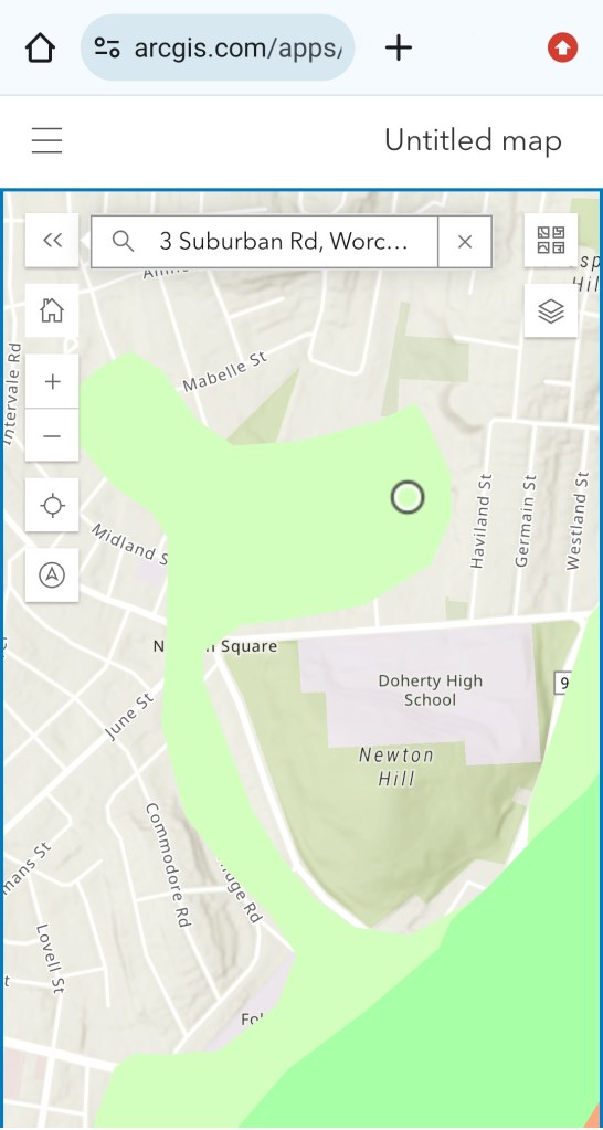
First of all, we know the site’s history as a peatlands which are a form of wetlands. We have two recent geotechnical surveys, one from Duffy Field to the west and one from the Haviland St side to the east that both show the presence of damp or wet peat and high groundwater. We can guess about what’s happening in between, but we can make that guess more valid using USGS maps that show swamp deposits and a “low yield” aquifer through the whole property.
All together, this evidence augments what was already a good hypothesis formed from observing the spongy ground, listening to neighborhood stories, or knowing that Highland West experiences “frost quakes” every winter. The ground consists of damp layers of peat, and has a high water table. Underneath the peat, according to one of the two recent geotechnical surveys, there are layers of wet gray sand and silt. That gray sand is sand that is always under water, otherwise it would be brown like most sand that has been exposed to oxygen. The land is always wet. It is, whether it looks like it or not, whether it deserves to have its flora protected or not, serving the role of a wetlands.
We don’t build on wetlands- theoretically since no one seems to be worried about this all of a sudden as if the human race has somehow, incredibly overcome all concerns about water- because they assist in groundwater recharge, protect the groundwater from surface pollutants, and serve a role in water retention and detention. Disturbing this kind of system would mean surface water enters the groundwater too quickly and overwhelms areas of lower elevation, coming up from under the ground into basements. Since we’re all on mounds of permeable glacial till over here, it’s hard to predict exactly how higher levels of groundwater could affect homes at higher elevations (let’s just say they’re not obviously out of danger), but it would most definitely affect Newton Square and the Elm Park area which are at lower elevations. Water could also just flow straight out of the property as surface flooding, which is a little more obvious of a problem. And if there are contaminants being held in the fill that has been dumped on the property- and we do know for certain that fill IS there from the geotechnical data as well- they could wind up wherever the water does. That’s especially concerning for groundwater, since it could give some of these potential contaminants a direct route into basements where they could build up as toxic gases, as has happened in similar situations. Even without the landfill, groundwater outgassing is still a concern given the high radon levels in the area- if you’re curious about how we know that, talk to anyone on Germain Street who has tested.
So no, this isn’t something that’s on one specific map. But there are several maps that give us clues, and when we put them all together, along with our own personal observations from living here, it’s almost as obvious as if it were.

Leave a comment